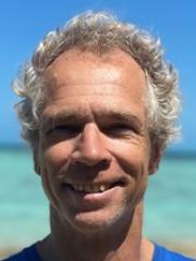
Associate Professor Chris Roelfsema

Researcher biography
Research interest: Monitoring ecosystem health of coral reefs and seagrass habitats, integrating field and remote sensing image datasets and approaches, and the developing cost-effective benthic habitat mapping approaches. Developing unique field methods for the calibration and validation of high/low spatial resolution, multi-/hyper-spectral airborne and satellite imagery in combination with object based and machine learning image analysis approaches. These methods have been adopted as standard practice in a number of resource management agencies and research institutes around the world.
Current projects: Principal investigator coral reef and seagrass habitat mapping projects:
1) Long term monitoring of benthic composition at Heron Reef. Ongoing since 2002, annual photoquadrate surveys are being collected at various site around Heron Island Research Station. The study was initiated to develop remote sensing mapping approaches and assess coral composition over time. Benthic and geomorphic maps, photo quadrates, spectral reflectance and field data are accessible online for Heron Reef.
2) Long term monitoring of seagrass composition and abundance in Moreton bay Marine Park. The studies form base line for develop remote sensing mapping approaches over time and space at local to global scale. The research initiated in 2000 is ongoing with, for Eastern Banks mapping seagrass species, cover and biomass. combining photoquadrate survey and satelite imagery (2004, 2007,2008,2009, 2011x2, 2012x2,2013x2, 2015, 2021,2022, 2023,2024) and mapping of seagrass extent and cover for Moreton Bay 2004, 2009, 2015, 2021, 2022 . Maps, photos, benthic and spectral data are accessible online for via Moreton Bay Research Station.
3) Smart Sat CRC Hyperspectral Remote Sensing of Seagrass and Coral Reefs 2023-2027. Collaborative effort with CSIRO, Adelaide University, DES Adelaide Coastal Waters.
4) 3D GBR Habitat Mapping Project 2015 - : Developing and implementing an approach to map for the first time the geomorphic zonation, bottom type and predicted coral type habitat for every single reef over the full extent of the inshore and offshore Great Barrier Reef, currently these maps do not exist to that level of detail funded through Great Barrier Reef Marine Park Authority.
5) Global habitat mapping project 2019-2023 Developed and implemented the validation and global habitat mapping component of the Allen Coral Atlas which created reef extent, geomorphic and benthic community maps for coral reefs globally and develop a monitoring system, in partnership with Paul G. Allen Vulcan Philanthropies; Planet; the Arizona State University and the National Geographic Society.
Other projects: Advisor for Reef Cloud Machine learning and reporting platform by Australian Institute of Marine Science and Coordinated Global Research Assessment of Seagrass System (C-GRASS), co-working group lead best practice.
Current position: Associate Professior in Marine Remote Sesning. Teaching and conducting research in marine monitoring and mapping from on infield photo based surveys to satelite based sensors. Academic Director Heron Island Research Station
Capacity building: teaching in under and post graduate courses; supervision of post-graduate students, national and international workshops/courses; and development of remote sensing toolkit https://www.rsrc.org.au/rstoolkit. Trainer in national and international workshops and online courses in coral reef remote sensing see (e.g. TNC)
Citizen science: Integrated in his research and as volunteer he is a strong supporter of citizen science based projects, which he represents as a trainer, organiser and scientific advisor with www.reefcheckaustralia.org/, www.coralwatch.org, www.citizensgbr.org and http://www.unidive.org/unidive-projects/ .


