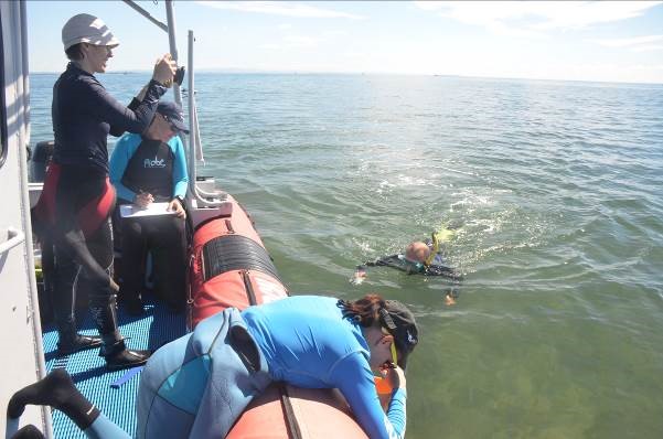
A two-year study involving satellite imagery and hundreds of reef site checks by volunteers has provided a critical update on the health of important reefs on Brisbane’s doorstep.
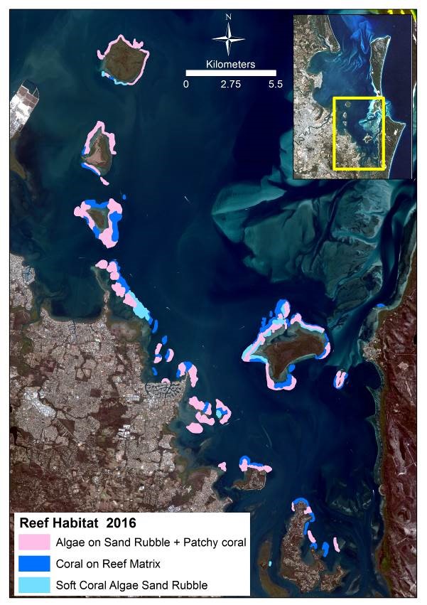
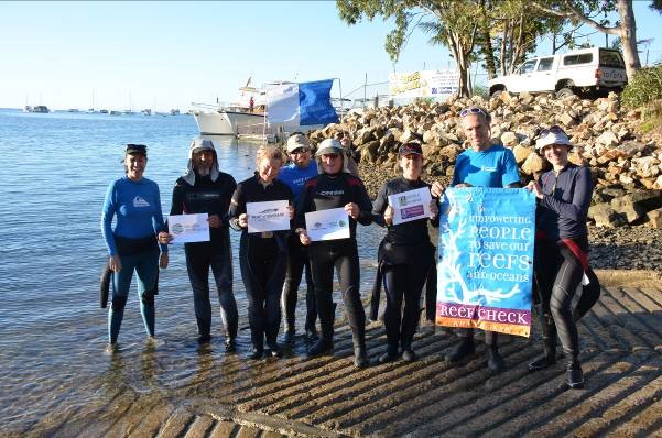
University of Queensland researchers, citizen scientists from Reef Check Australia and Healthy Waterways and Catchments researchers partnered to create the revised map for Moreton Bay’s coral habitats.
UQ Remote Sensing Research Centre researcher in UQ’s School of Earth and Environmental Sciences Dr Chris Roelfsema said the study helped fill in a decade-long gap since the last detailed spatial assessment of the Bay’s coral habitats.
“The report sets a comprehensive baseline for the distribution of critical Moreton Bay reef habitats,” he said.
“Combined with regular reef condition surveys, this dataset is a critical resource for science-based management in the Bay.”
Reef Check Australia Director of Programs and Partnerships Jennifer Loder said corals were critical indicators for Moreton Bay health.
“Their increasing sensitivity to environmental conditions and proximity to rapidly growing populations mean it is increasingly important to understand these habitats and monitor change,” she said.
Dr Roelfsema used previous studies, including data from 2004, and high resolution satellite images to identify key locations for trained volunteers to conduct spot checks to validate mapping.
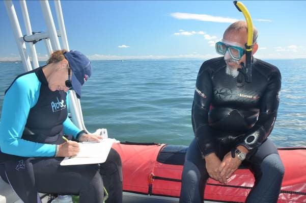
Volunteer citizen scientists with Reef Check Australia visited more than 600 sites across the Bay to record data about reef composition.
The field data and high resolution satellite imagery were used to refine the 2004 maps that outline the habitat type and extent across key reef areas in Central Moreton Bay and fringing the mainland.
“The new maps cannot be directly compared with previous maps that measure change, due to improved technology,” Dr Roelfsema said.
“However, results broadly indicate there has not been major change in the extent of reefs in Moreton Bay. Importantly, the study creates a revised baseline for future comparison.
“The project also documented some new reef areas, not previously mapped, including on the north-western side of Peel Island.”
Dr Roelfsema, who led the mapping, said the project demonstrated the value and possibilities of partnerships between scientists, volunteers and managers in finding practical solutions to data needs.
“Unlike the Great Barrier Reef, south-east Queensland has limited established monitoring programs to track the condition of coral habitats. This is just one reason why this research is so important and why citizen science has an important role to play,” he said.
Healthy Waterways and Catchments CEO Julie McLellan said the data would now contribute directly to the organisation’s annual Report Card.
“This will help evaluate the effectiveness of catchment-level natural resource management investments and support evaluation of natural resource management project outcomes,” Ms McLellan said.
Redland City Mayor Karen Williams said the project was critical for managing coral reefs off the City’s coast.
“As a coastal city, it is important to us that we have the best information possible to help us to look after the bay and its reefs,” Cr Williams said.
State Environment Minister Dr Steven Miles welcomed the continued focus on water quality in Moreton Bay and the overall health of the catchment, and praised the important contribution community members could make in partnership with science and management.
The study, Benthic Inventory of Reefal Areas in Central Moreton Bay, was supported by the Australian Government’s National Landcare Program, Redland City Council, and Port of Brisbane Pty Ltd community grants.
Media: Dr Chris Roelfsema c.roelfsema@uq.edu.au, +61 7 336 56977 or Jennifer Loder, jenn@reefcheckaustralia.org, 0402 284 681.


